-
Categories
- E-commerce Websites
- Content Management Systems (CMS)
- Blogs and Personal Websites
- Corporate and Business Websites
- Portfolio Websites
- Social Media Websites
- Educational Websites
- Entertainment Websites
- Non-Profit and Charity Websites
- Landing Pages
- Web Portals
- Forums and Community Websites
- Review and Rating Websites
- Smart Home Apps
- Wearable Apps
- Healthcare and Medical Apps
- Industrial IoT (IIoT) Apps
- Smart City Apps
- Connected Vehicle Apps
- Agriculture IoT Apps
- Retail and Supply Chain Apps
- Smart Building Apps
- Energy Management Apps
- Fitness and Sports Apps
- Environmental Monitoring Apps
- Security and Surveillance Apps
- Personal Assistance Apps
Websites Development
IoT Mobile Apps
GPS System Integration
- Home
- Categories
- System Integration
- GPS System Integration
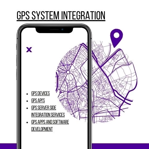
BVTECH GPS (Global Positioning System) integration involves incorporating GPS technology into various applications and devices to provide location-based services. This includes working with GPS devices, APIs, server-side integration, and developing GPS-enabled applications and software. GPS integration is widely used in navigation, tracking, mapping, and location-based services.
GPS Devices
Types of GPS Devices:
- Handheld GPS Units: Portable devices used for navigation and tracking in outdoor activities.
- Vehicle GPS Units: Installed in vehicles for navigation and fleet management.
- Smartphones and Tablets: Built-in GPS receivers used in mobile devices.
- Wearable GPS Devices: Fitness trackers and smartwatches with GPS capabilities.
Features:
- Real-Time Location Tracking: Continuously provides the current location.
- Route Planning and Navigation: Offers turn-by-turn directions and route optimization.
- Geofencing: Creates virtual boundaries and alerts when entering or leaving specific areas.
- Data Logging: Records location data for analysis and historical tracking.
GPS APIs
Popular GPS APIs:
- Google Maps API: Provides mapping, geolocation, and navigation services.
- OpenStreetMap API: Open-source mapping and geolocation services.
- Mapbox API: Offers customizable maps and location services.
- Here API: Location services including mapping, geocoding, and routing.
Key Features:
- Geocoding and Reverse Geocoding: Converts addresses to coordinates and vice versa.
- Mapping: Displays maps with customizable layers and markers.
- Routing and Navigation: Provides route calculation and navigation guidance.
- Location Tracking: Real-time tracking of devices and users.
GPS Server-Side Integration Services
Server-Side Technologies:
- RESTful APIs: Web services for communicating between client applications and GPS data servers.
- WebSockets: Real-time bi-directional communication for live location updates.
- Database Management: Storing and querying location data (SQL, NoSQL).
Key Features:
- Data Aggregation: Collects and processes GPS data from multiple sources.
- Real-Time Data Processing: Handles live location updates and triggers events based on location changes.
- Historical Data Storage: Stores past location data for analysis and reporting.
- Scalability: Ensures the system can handle a large number of concurrent users and devices.
Security:
- Data Encryption: Ensures the secure transmission and storage of GPS data.
- Authentication and Authorization: Controls access to GPS data and services.
- Compliance: Adheres to privacy regulations (GDPR, CCPA).
GPS Apps and Software Development
Mobile Applications:
- Navigation Apps: Provides turn-by-turn navigation and route planning (e.g., Google Maps, Waze).
- Tracking Apps: Monitors the location of assets, vehicles, or individuals in real time (e.g., Find My, Strava).
- Fitness Apps: Tracks outdoor activities like running, cycling, and hiking (e.g., Garmin Connect, Fitbit).
Web Applications:
- Mapping Portals: Interactive maps for displaying and analyzing location data (e.g., Google Maps).
- Fleet Management Systems: Monitors and manages fleets of vehicles using GPS data (e.g., Fleet Complete).
Desktop Software:
- GIS Software: Geographic Information System applications for spatial data analysis (e.g., ArcGIS, QGIS).
- Navigation Software: Desktop applications for route planning and navigation.
Development Process:
- Requirement Analysis: Define use cases, user stories, and technical specifications.
- Design: Create wireframes, mockups, and system architecture.
- Development:
- Frontend: Develop user interfaces using web or mobile technologies.
- Backend: Implement server-side logic, database management, and API integration.
- Testing:
- Conduct unit, integration, and system testing.
- Perform real-world testing to validate GPS accuracy and performance.
- Deployment: Deploy the application to app stores, web servers, or desktop environments.
- Maintenance: Provide ongoing support, updates, and enhancements.
Conclusion
GPS system integration involves a combination of hardware and software solutions to deliver precise location-based services. By leveraging GPS devices, APIs, server-side technologies, and development best practices, developers can create robust applications for navigation, tracking, and various other location-based services.
- New


